

Lucky One on Mt. Aspiring by Paul Dale
/
Mt. Aspiring from the Colin Todd hut
Throughout the heyday of my interest in mountaineering, the Southern Alps of New Zealand held a magical sway. So far away. So unknown. Outside the sphere of possibility. So when Karen and I first signed up for an AMC Adventure Travel hiking trip to New Zealand, I thought immediately of Mt. Cook and Mt. Tasman, the only two peaks I could name from memory.
A little research showed that these would be outside the sphere of possibility. Both are serious snow and ice climbs only attempted in spring and summer when conditions are right and the glacier approaches are passable because there are still snow bridges over the crevasses. But we would be there in March, the fall season (equivalent to our September).
Even if the season had been right, at an emotional level I was not ready. The photos of knife edge ridges of soft (presumably unstable) snow, cornices, large packs and a rack of snow pickets are above my comfort level.
A little further investigation located Mt. Aspiring, a fine alternative 90 miles further south and the centerpiece of Mt. Aspiring National Park. This is a classically shaped mountain with 3 distinct ridges. It stands alone with no other nearby peaks to diminish its prominence.

Mt aspiring from roy’s peak 30 miles to the south east of the mountain
It is often called "the Matterhorn of the Southern Alps." A two-page spread of the winning photo in the 2018 Climbing magazine photo contest went to a picture taken from the South West Ridge. That ridge is a snow and ice climb that would be out of season, but the long North West Ridge is a great late season option. It is a moderate rock climb up a sharp ridge with many gendarmes, culminating in a summit ice cap.
The members of the AMC hiking trip were not interested in this project and moreover even if I had a partner I would not have been comfortable organizing my own trip in mountains I knew little about. Mt. Aspiring is at 440 south latitude, below the latitude of Tasmania in the part of the world known to sailors as the “roaring 40's.” The west coast of the South Island is one of the wettest climates in the world. The Milford Track that I hiked with the AMC group averages over 20 feet of rain per year. From the slopes of Mt. Aspiring we saw the Tasman Sea 25 miles to the west. The mountain catches the storms that roll in.
I hired a guide; an unusual experience for me. The package was for 5 days which allows enough time to sit out some bad weather to increase the probability of success. Gary Dickson is 53 and has been guiding for 30 years. He is a past president of the New Zealand guides association and active in search and rescue. He met me the morning after the AMC trip ended and without delay we headed for the helicopter facility part way up the Matukituki ("ma-tuki-tuki") Valley that leads toward the mountain. The weather the last few days had been excellent but the forecast was for deteriorating conditions, getting worse as time went on. Hence the haste.
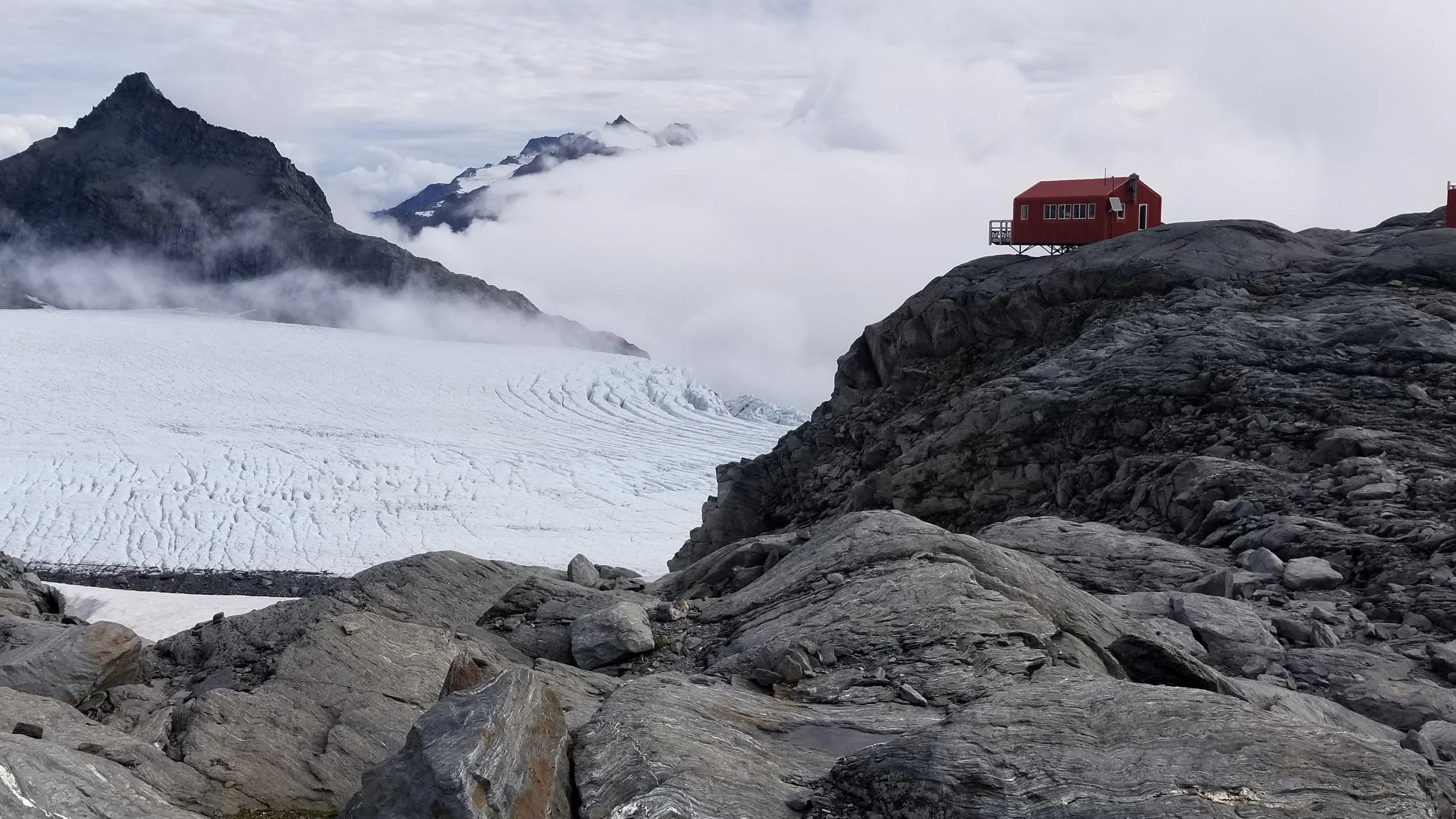
The Colin Todd hut sits below the base of the ridge. There is a way to hike in but this involves 10 or more grueling hours with packs. (At the hut we met a very strong climbing couple from Colorado who had reached the summit and they, on a limited budget, had opted to fly in).
Helicopters are not allowed in the wilderness area so the landing spot is Bevan Col just outside. Flying was in doubt because of the persistence of low clouds but the pilot found a spot to land nearby.
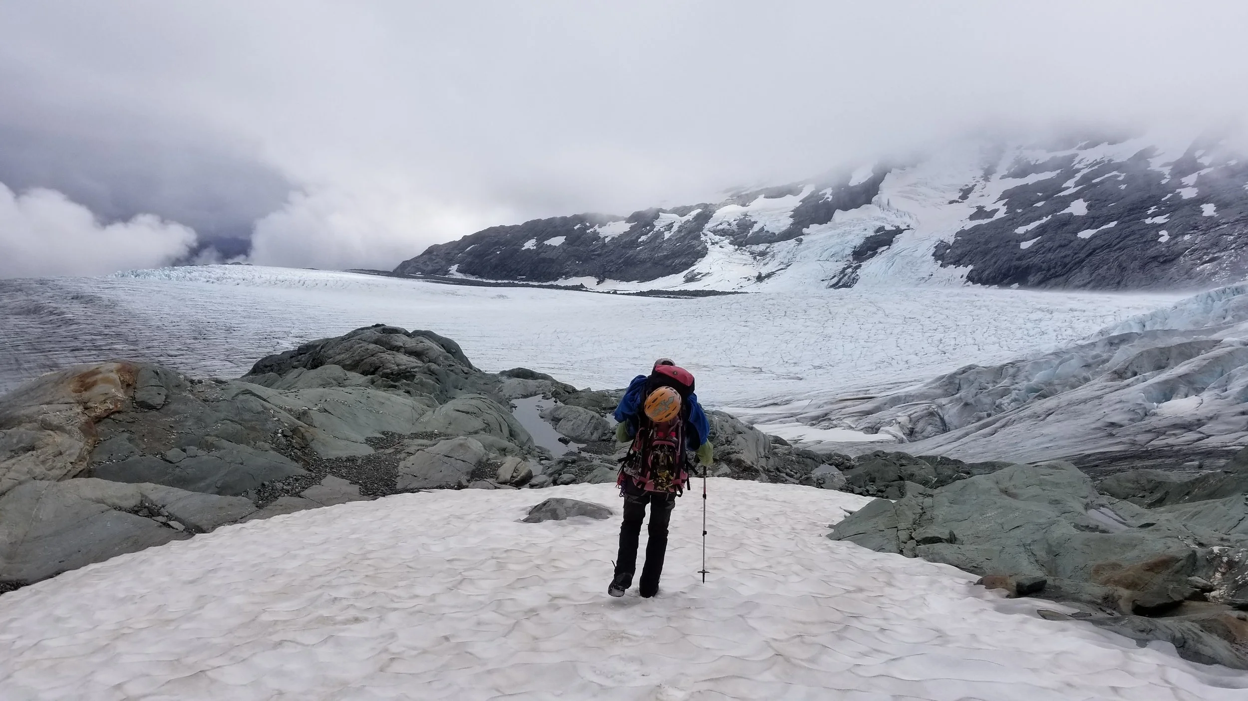
Approaching the Bonar Glacier. The Colin Todd hut is in the clouds on the ridge beyond. Gary was not a photographer, so most of the pictures are mine taken of him.
I found that climbing with a guide introduced some interesting human dynamics. Neither of us knew what to make of each other at first. Gary was initially quiet, "business only,” and I didn't want to step out of line. The hut is 2 to 3 hours away, reached by descending to a level portion of the Bonar Glacier, crossing it without difficulty and ascending to the hut on the other side. When we landed we saw our destination, a small dot on the far ridge, but by the time we were on the glacier it was lost in a heavy cloud that had descended.
From the hut, Gary wanted to reconnoiter the first part of the route which goes up Shipowner tower. Normally one can bypass this part way up by going out onto a glacier and around the back side. But even in the fog and mist we could see that the moat made this impossible; we would have to climb the tower and rappel the backside (and re-climb this on our return).
I was quickly learning the advantage of having someone who knows the route and the options. Careful route finding was needed on the whole ridge. The couple from Colorado reflected on their route finding challenges and the lack of route beta that we are familiar with in N. America.
The forecast was for a clear morning followed by likely showers in the afternoon. We set the alarm for 5am and went to bed with the mist hanging around the hut.

Inside the Colin Todd hut. There are mattresses and camp stove, but you bring your own sleeping bag, fuel, and food.
At 5am we saw some stars above and thought we were good to go, but shortly after it started to rain. Gary said let's go back to bed for an hour. We did, and the rain stopped and we started up at 6:50. We were in between two layers of clouds. Part way up the tower Gary could look out to the Tasman Sea. He did not see major storm clouds and declared that we could go on. Ah, the benefit of local weather experience.
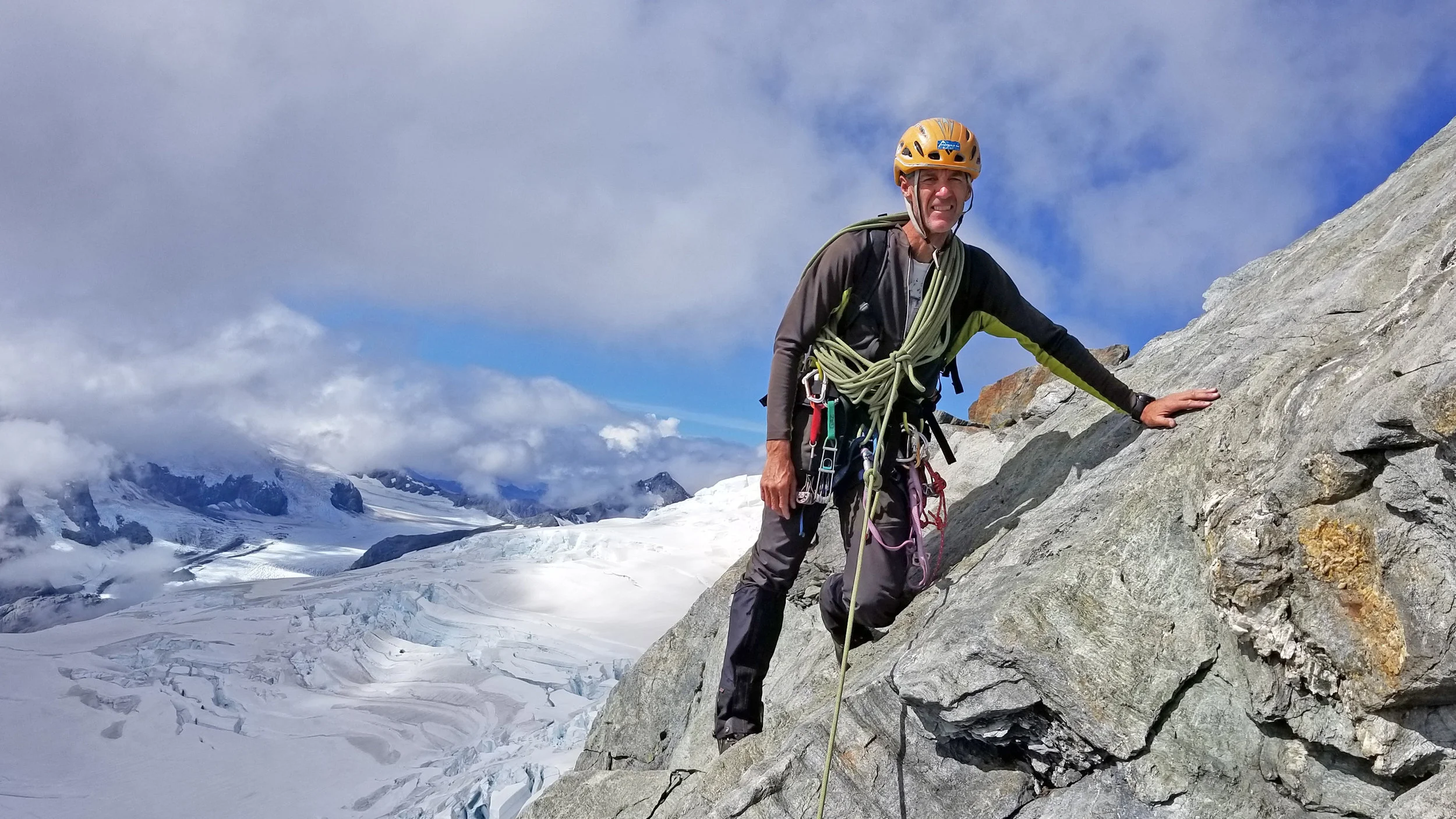
The ridge involved lots of 4th class climbing with an occasional short pitch. There are sections with great exposure and long horizontal sections on the crest - a classic interesting ridge climb. There are a number of towers all of which can be bypassed to one side or the other and one steep buttress. Near the top of the ridge, it broadens and meets the summit ice cap.

Looking out from a cliff band

Rappel down Shipowner tower
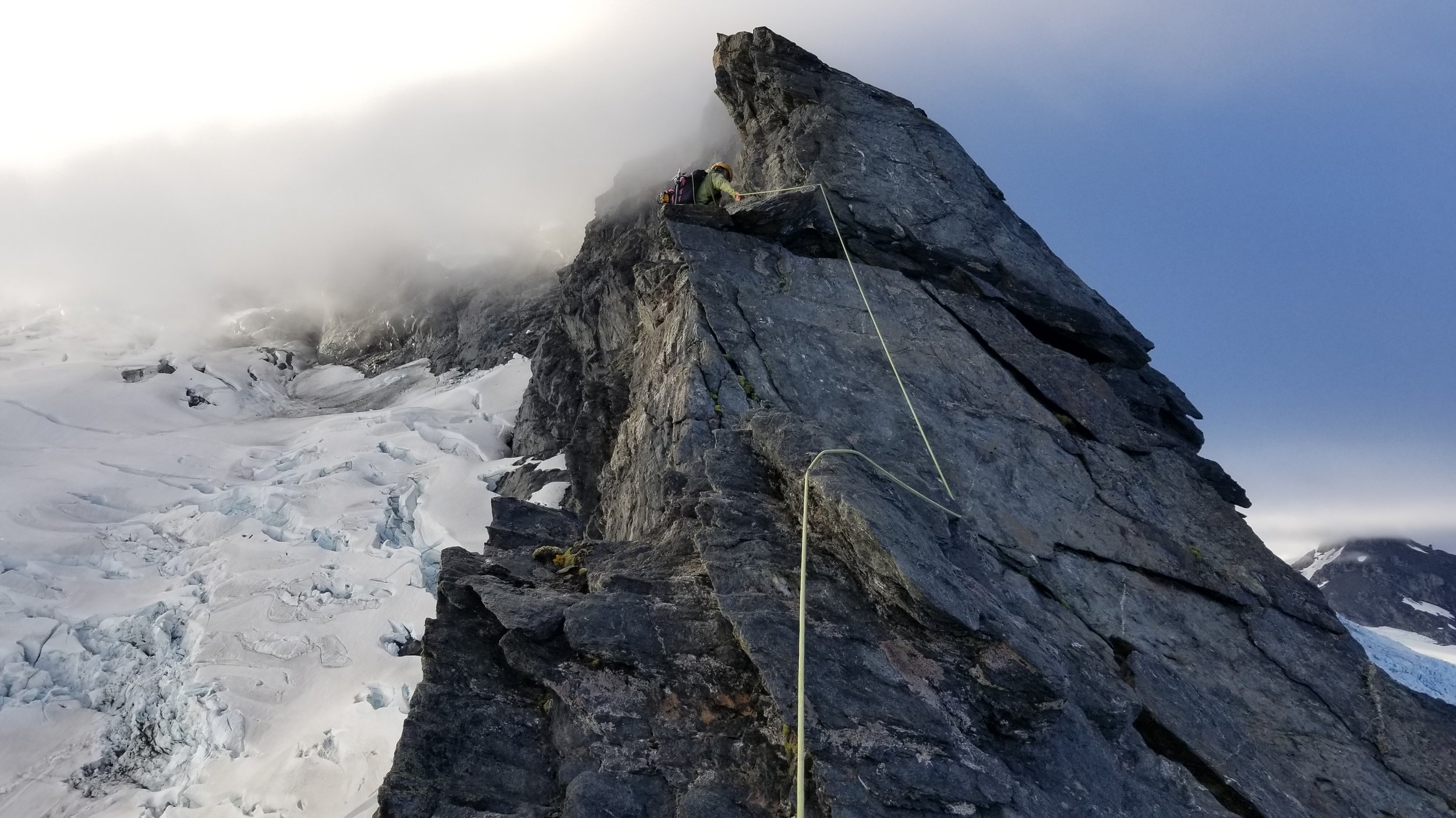
Gary going into the cloud
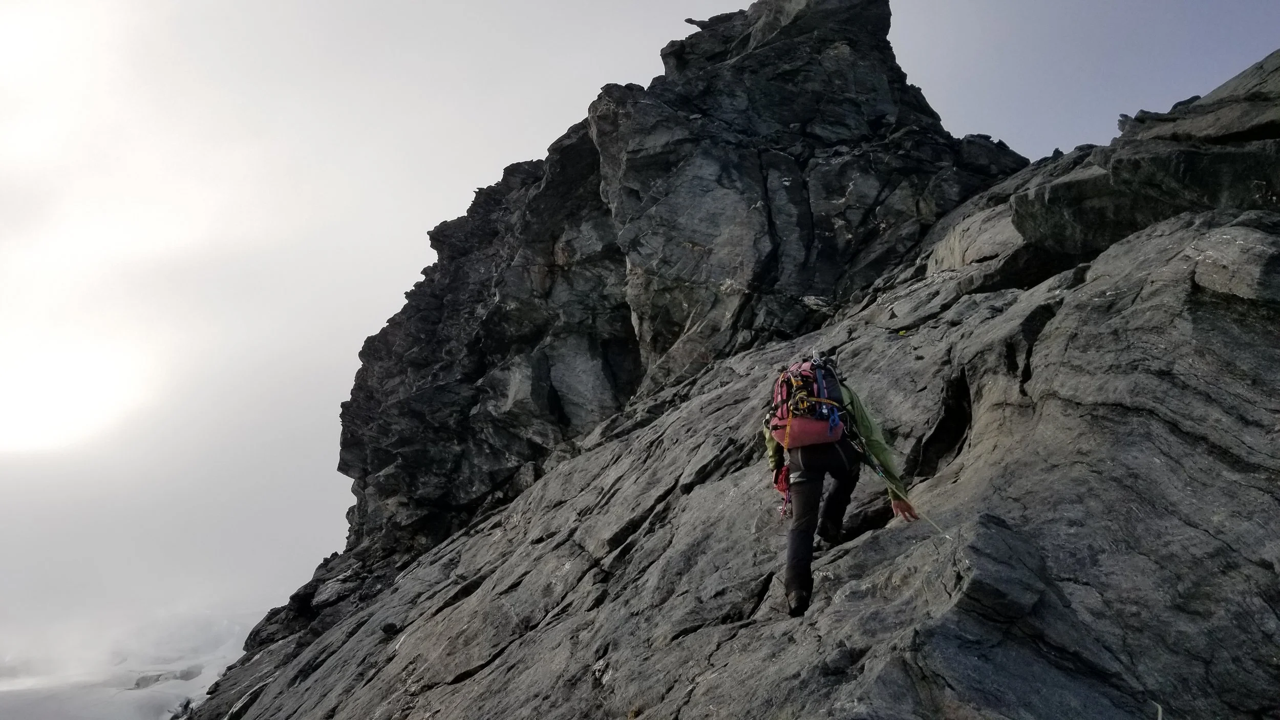
Approaching the buttress
At the beginning of the day I was worried that the weather would close in, rain would start and we'd be involved in a long, exposed descent down slippery rock. We climbed into the clouds part way up, but I was a lucky one; the weather improved as the day went on and my spirits rose when the sun first came through.
When we reached the summit, the cloud cover was well below us. We looked out on a sea of clouds in all directions. Not a single peak pierced this layer. We had that “on top of the world” feeling.
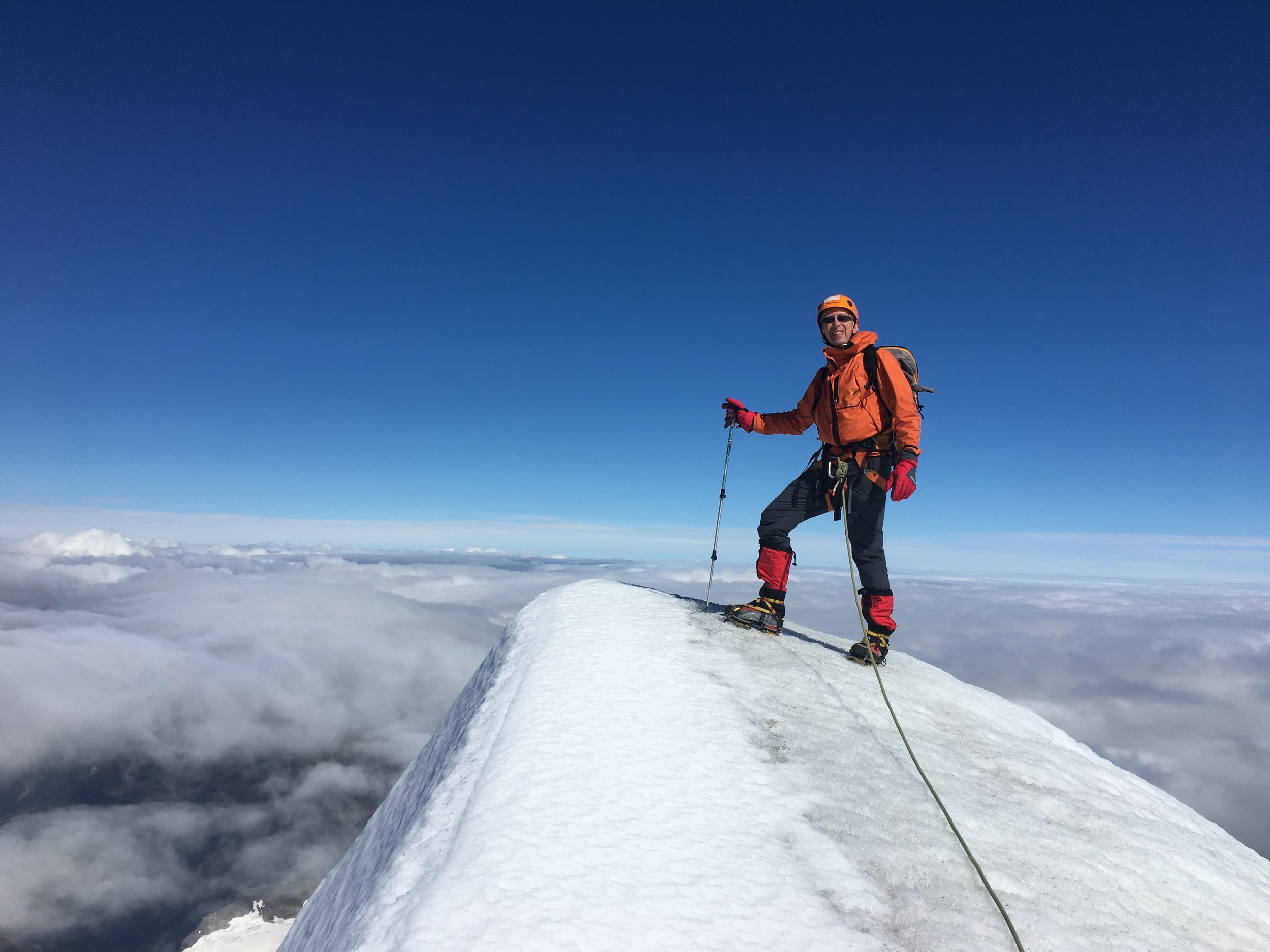
We each carried an ice axe for the summit ice cap, but with global warming the ice has retreated so much that we did not feel the need to use an axe. We were comfortable in just crampons.
On the descent we down climbed and rappeled a few short, steep sections. The anchors are all in place if you know where to look ... We took 11 hours round trip.

On rappel
Gary


On descent, climbing out of one of the notches

Final descent to the hut, Bonar Glacier behind
The water supply for the hut is from a rooftop rain water collection system

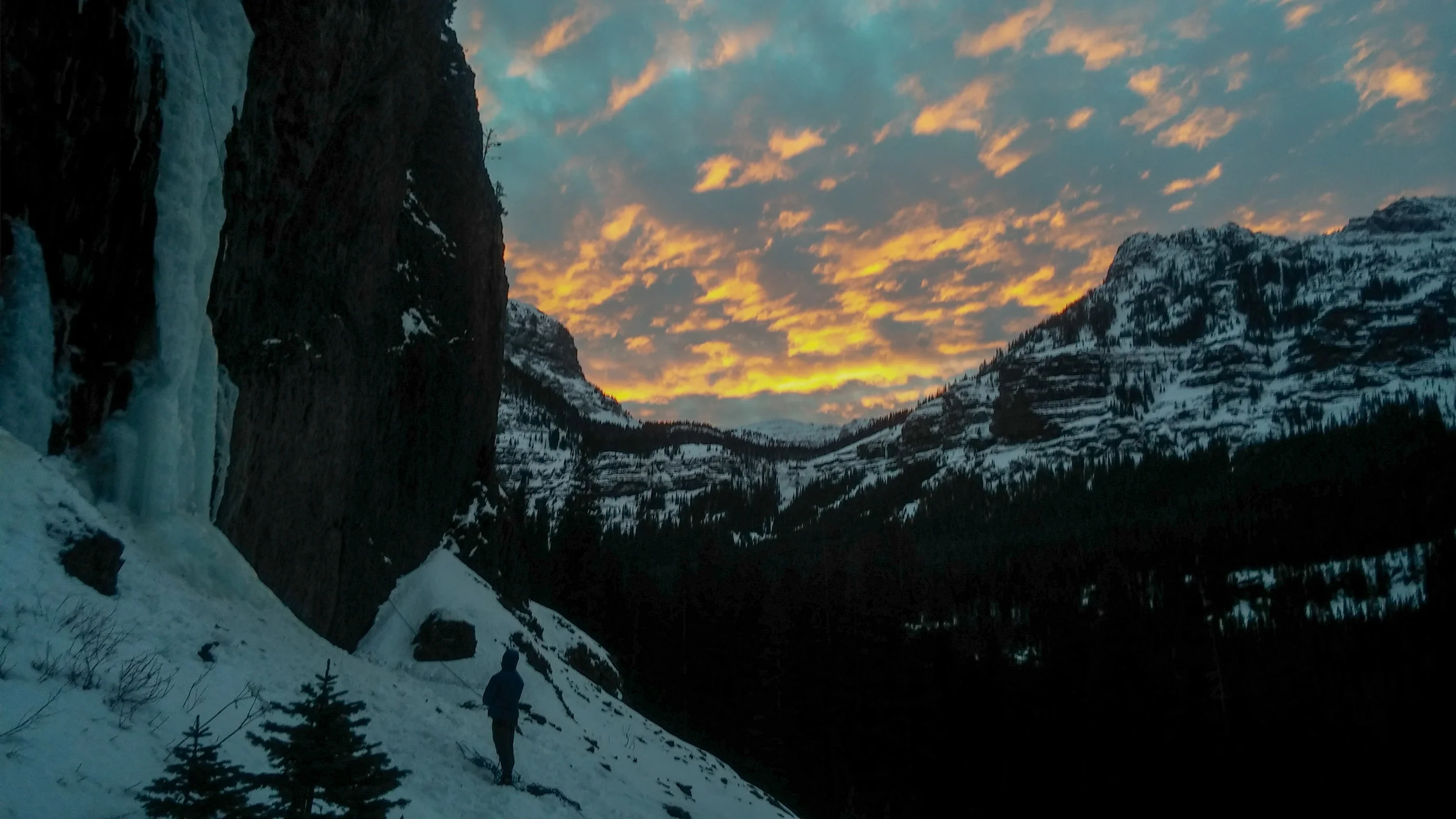
Sunset from the hut the evening we returned. (Gary thinks this could be submitted to the photo contest in the New Zealand Alpine Club magazine)
The next day we re-crossed the glacier and flew out.
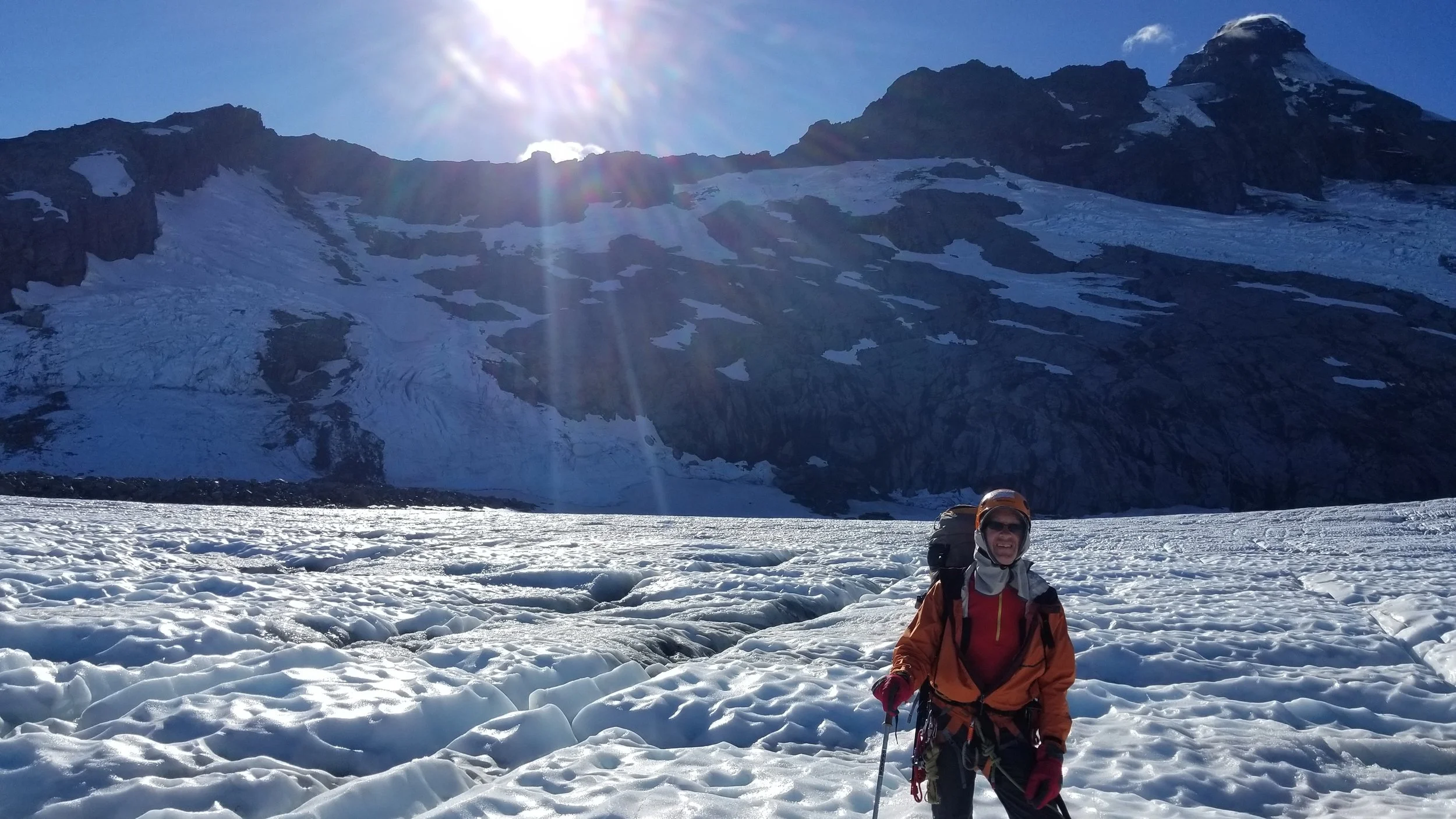
On the Bonar Glacier with the full nw ridge behind
The following day we went sport climbing at the local crags and on the final day, we did the Grand Traverse of the Remarkable Mountains that dominate the skyline above Queenstown. This was another long semi-technical roped ridge climb which we did with light packs in full sun.


Queenstown on the far side of the lake below
I was lucky in many ways. Gary and I got on well together, good fall weather dominated the time I was in New Zealand, and my legs and feet held up - which was sometimes in doubt. But there is no doubt that this was a great climbing experience.